Monitoring keeps track of work and keeps the work on track

By MERI (Monitoring) Officer
Marc McConnell
Large gullies are a major contributor to land loss and degradation, removing valuable soil resources from properties.
This is reflected in poor water quality downstream and in the BBB catchment.
NQ Dry Tropics’ large-scale gully monitoring program is yielding results to assist land managers operating in the catchment to apply the most appropriate treatments to ensure successful gully repair and retain soil resources.
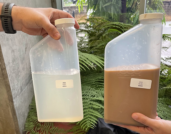
Flow event samples from the treated site at Glen Bowen (left) and the control, or untreated site. The efficacy of the remediation is clear.
MONITORING LARGE-SCALE GULLIES
Large gullies are a major contributor to land degradation and poor water quality in the BBB catchment.
NQ Dry Tropics’ large-scale gully monitoring program is yielding results to assist land managers operating in the catchment to apply the most appropriate treatments to ensure successful gully repair.
Five large-scale remediated gully sites are monitored as part of our long-term gully monitoring, each with a different treatment or in a different geographic setting and each with an untreated control site nearby.
At each site, we measure:
- Land condition: ground cover percentage and composition; gully floor walls and site.
- Local rainfall.
- Total suspended solids (TSS) SS and Total Nitrogen. Total suspended solids (TSS) refers to waterborne particles exceeding two microns. While some sediment will settle at the bottom of a water source, other TSS will float on the water surface or remain suspended somewhere in between. TSS affects water clarity, so the higher a water source’s TSS content, the less clear it will be.
- Total Nitrogen (TN) is the sum of all nitrogen forms.
- Velocity.
- Photos linked to sampling.
The 2021-22 wet season generated 29 flow events across the monitored gullies with hundreds of samples taken. This year’s findings will be published later this year.
Why is it important?
Monitoring and evaluation is important because it:
- provides the consolidated source of information, showcasing project progress;
- allows stakeholders to learn from each other’s experiences, building on expertise and knowledge;
- generates reports that contribute to transparency and accountability, and allows for lessons to be shared more easily;
- offers paths for learning and improvements;
- provides a basis for questioning and testing assumptions;
- provides a means for agencies seeking to learn from their experiences and to incorporate them into policy and practice;
- provides a way to assess the crucial link between implementers and beneficiaries on the ground and decision-makers;
- adds to the retention and development of institutional memory; and
- provides a more robust basis for raising funds and influencing policy.
The focus of this section has been on how the project monitors and evaluates large-scale gully remediation, but LDC also monitors small-scale gully works, rehydration works, and grazing land management practice changes.
To measure the effectiveness of these activities, LDC has a suite of tools to suit each property project including looking at the general land condition and soil types, mapping, before and after photos, and water and soil sampling.
This information helps LDC to provide graziers with the tools and resources to implement sustainable land management decisions on their properties.
Before and after the work at Mt Wickham.
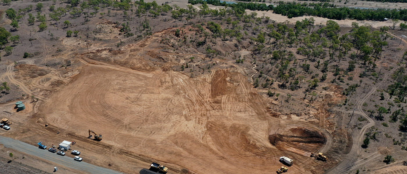
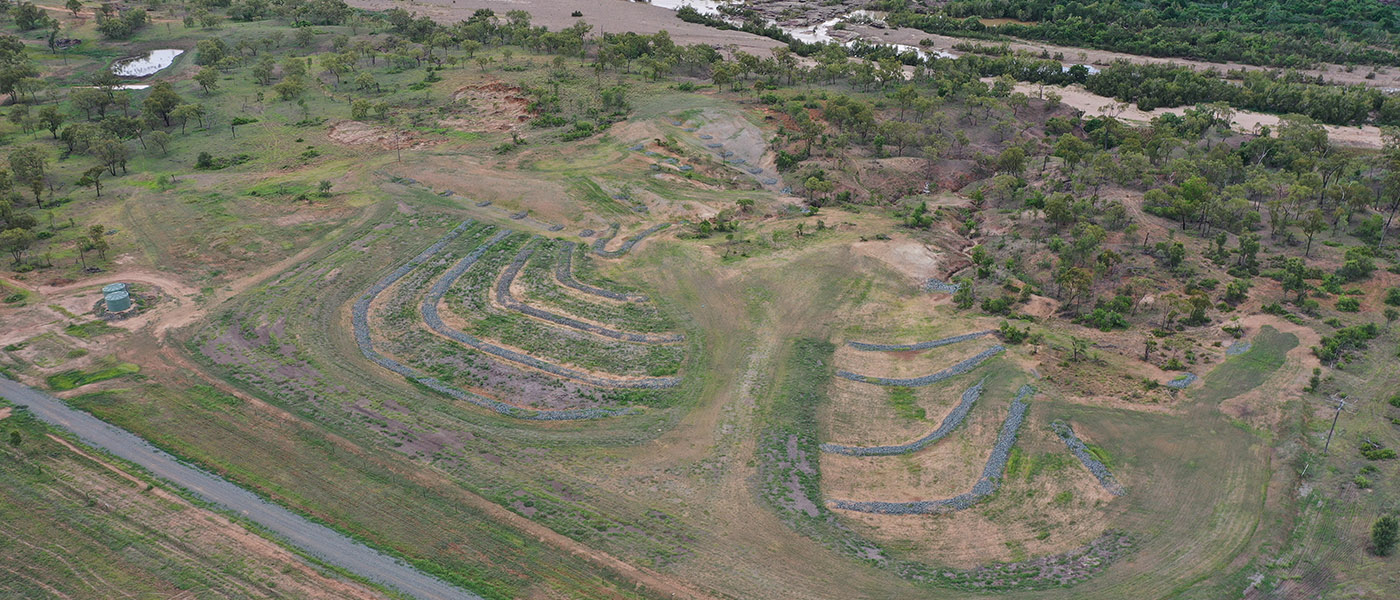
The result of the first of two large-scale gully remediation projects at Glen Bowen Station is a picture.
GLEN BOWEN
Three sites treated along the Bowen River
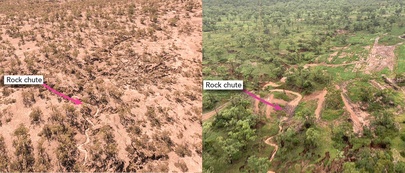
Three sites, covering an area of 10.2ha have been treated. They are part of an extensive gully system adjacent to the Bowen River.
To control how the water flows, including slowing it down so the land soaks it up, treatment included reshaping and battering the active gullies, installing rock chutes and bunds and establishing vegetation.
The first automatic monitoring triggered by a rain event early in 2022 showed an 85 per cent increase in water staying in the landscape during the rain event. The results were: 52,800mg/L coming from the untreated site compared to only 794mg/L at the treated site. This demonstrates the tremendous success of the treatment.
Total suspended solids transported from the Glen Bowen control gully peaked at just below 70,000 mg/L while the treated gully yielded less than 200mg/L.
Overall the median values from the two sites were 794mg/L at the treatment site to 52,800mg/L at the control. For context, water transporting 10mg/L or more is sufficient to affect seagrass growth rate.
The median sediment size transported from this area is 7um (superfine). Grains this size are quick to be transported and once suspended remain in the water column for long periods of time.
Long term monitoring of remediated gullies provides us with important information on treatment effectiveness. The sites monitored can give us a broad understanding of what the best, most cost effective way to bring gullied land back into production.