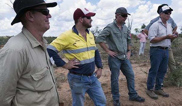
Pictured during a scoping field trip are (from left) Scientist Andrew Brooks, Glencore Environmental Officer Adam Heap, Scott Robinson Department of Environment and Heritage Protection and CEO NQ Dry Tropics Dr Scott Crawford
Determining the scope and objectives of the Landholders Driving Change project
THE Burdekin River Basin is ~130,000 km2 and drains into the Great Barrier Reef lagoon south of Townsville.
It has the largest mean annual runoff of any of the GBR catchments at 10,290,000ML, and is the largest contributor of anthropogenic derived fine sediment to the GBR lagoon (Waters et al., 2014; McCloskey et al., 2017a,b).
The Burdekin River and its catchment influences large areas of coastal floodplains and important wetland areas, coral reefs and seagrass beds. Many of these systems are vulnerable to increases in sediment and particulate loads in the environment.
Flood plume studies have found most sediment exported from the Burdekin Basin is deposited close to the river mouth, coastal and inner shelf areas of the GBR, with potential for remobilisation during subsequent wind and tide driven resuspension events (Bainbridge et al., 2016; Lewis et al., 2015).
These resuspension events can result in higher turbidity levels than measured in initial flood plumes. Elevated turbidity reduces light for seagrass and corals.
While coastal seagrass and coral reefs do grow in turbid water conditions at shallow depths, this has contributed to declines in seagrass extent (McKenzie et al., 2016) and reduced coral biodiversity (De’ath and Fabricius, 2010) throughout the GBR.
Within the Burdekin River Basin there are several large catchments, and there are now multiple lines of evidence showing that the BBB catchment, which is downstream of the Burdekin Falls Dam, is the dominant source of sediment and particulate nitrogen to the GBR (Lewis et al., 2015; Bartley et al., 2014), contributing approximately 43% of the regional sediment load.
This catchment has some of the highest sediment concentrations and one of the highest per-hectare sediment loads of any catchment draining to the GBR lagoon (Dougall et al., 2014), and these erosion rates are ~7.5 higher than natural (Bartley et al., 2015).
The dominant erosion process driving this excess sediment delivery is gully erosion (Wilkinson et al. 2015; Hancock et al. 2014), and a large proportion of the sediment is generated from grazing lands. Accordingly, the Burdekin Water Quality Improvement Plan (Burdekin WQIP; NQ Dry Tropics, 2016) identifies the BBB as the highest priority catchment for sediment loss in the Burdekin Basin.
Within the BBB catchment, most of the sediment load is delivered from a relatively small proportion of the area, which has vulnerable soils that are hydrologically well‐connected to the stream network.
These are primarily where subsoil is exposed in scalds, rills and gullies (Wilkinson et al., 2015; Brooks et al., 2016). These features can be identified in the landscape, but the critical gap in our understanding is the effectiveness of erosion remediation options for controlling these sources of sediment at property and sub-catchment scales.
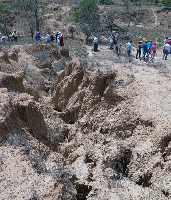
A scoping trip at Havalah Station during the Design Phase of the LDC project
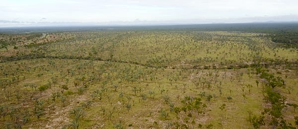
Strathalbyn Station was one of the BBB properties visited during scoping for the Design Phase of the Landholders Driving Change project
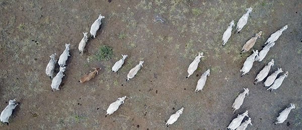
Cattle in the BBB