Property plan with accuracy — remove the guesswork with mapping
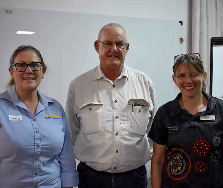
NQ Dry Topics Project Officer Cherry Emerick (left) with Glencoe grazier Bob Harris and Department of Resources Maree Cali.
Two Mile grazier Graham Gordon and Department of Resources’ Maree Cali.
NQ Dry Tropics Grazing Support Officer Sheridan Callcott and Glencoe grazier Bob Harris.
Local graziers have taken part in a Maps and Apps workshop to learn how Queensland Globe can assist with property management and planning.
Graziers were provided with the knowledge, skills and tools to produce customised maps of their property to help them plan, analyse and monitor their property infrastructure.
Workshop organiser NQ Dry Tropics Landholders Driving Change Senior Project Officer Cherry Emerick said Queensland Globe was a free, mobile-friendly tool which allowed graziers to zoom in to their property and overlay that image with property-specific information such as water catchments, soil types and terrain.
“Its real power is the ability to easily overlay the picture with data layers – ranging from flood mapping lines to vegetation management mapping,” Ms Emerick said.
“Property boundaries, soil types, proximity to local roads, rail lines, water catchments are all available on the Queensland Globe, together with detailed location-specific grazing land management, topography, and hundreds of other datasets.
“Graziers are able to draw fencelines and water points, measure paddock sizes, calculate elevations, view historical satellite imagery and access vegetation management layers.
“This provides graziers with the power to make informed decisions with reliable, up to date information in the one place.”
Grazier Jon Haucke, of Heidleberg Station, agreed.
He said the ability to overlay specific data on his property map provided information to help support decision-making for property management.
“It’s been invaluable information for setting up property maps going forward,” Mr Haucke said.
Workshop participants also learned how to use Avenza Maps, a mobile map app that allows users to download maps for offline use on smart phones or tablets. Users can also plot and record information about locations, import and export place marks, measure distance and area, and plot photos.
Three presenters from the Department of Resources helped guide graziers through the process. Ms Emerick said the presenters provided one-on-one demonstrations to help aid learning.
Department of Resources Kylie Jones with NQ Dry Tropics staff members Brad Martin (left) and Josh Nicolls.
Byweren grazier Stacey Haucke, Department of Resources representative David Lin (standing) and Heidelberg grazier Jon Haucke.
NQ Dry Tropics Graduate Grazing Extension Officer Brad Martin completing a mapping exercise during the workshop.


