Rehabilitating gullies to improve water quality
Phase two of gully remediation at Glen Bowen has been completed.
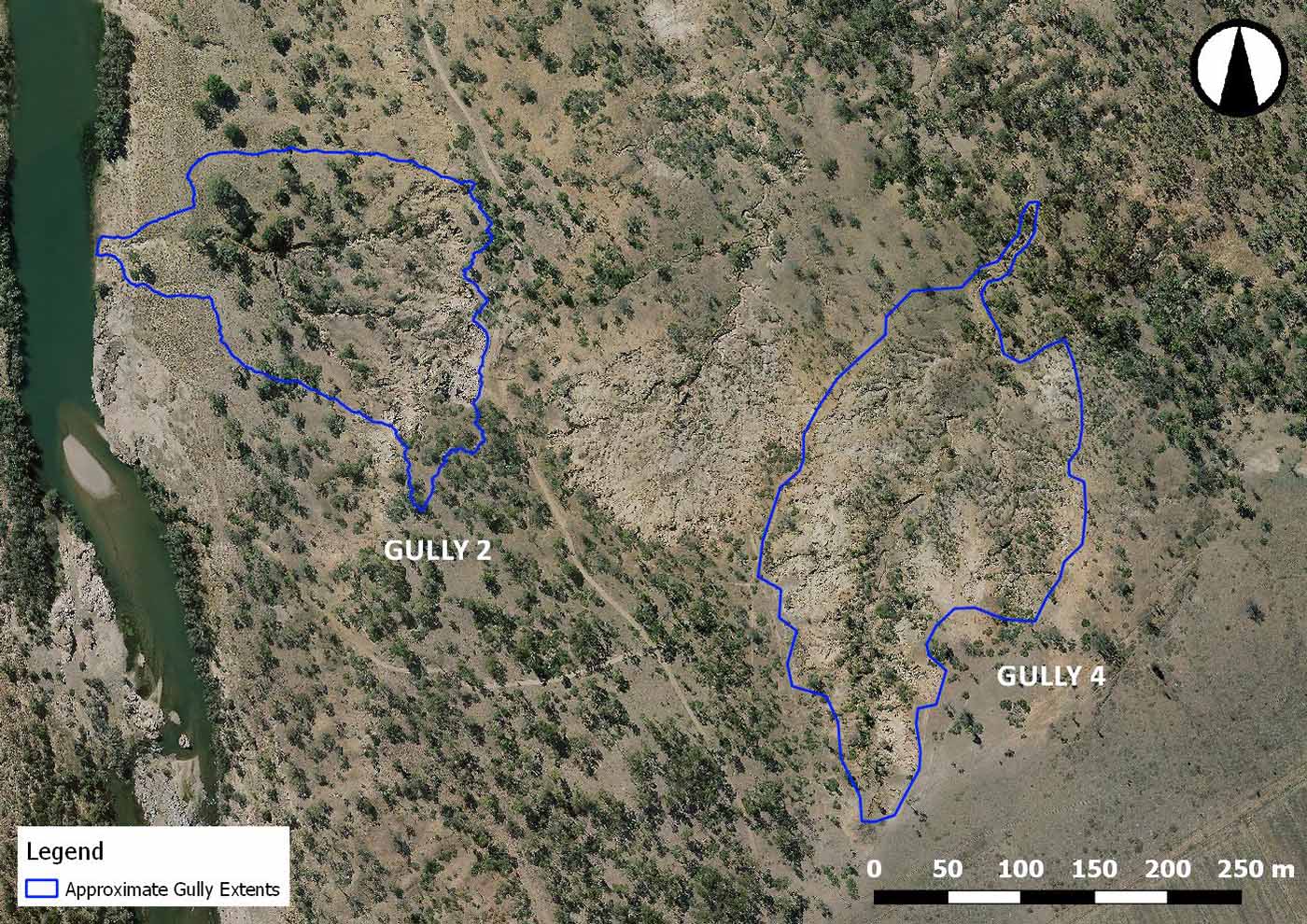
The two alluvial gullies, called Gully 2 and Gully 4, are shown (right).
Engineering firm Neilly Group developed the gully remediation technical design for these two gullies, and project managed the works. Local contractors completed the on-ground works.
This work follows the remediation of Gully 1 that was carried out on Glen Bowen in 2019, read about it here.
Site overview: Gully 2 and Gully 4.
Gully 2
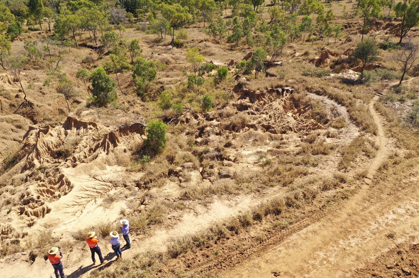
Gully 2 is a typical alluvial gully formation where its catchment is largely itself. It is eroding primarily through direct rainfall alone, which indicates that the soils are highly dispersive.
This has been confirmed by soil testing results presented in the assessment report (Griffith University, 2019).
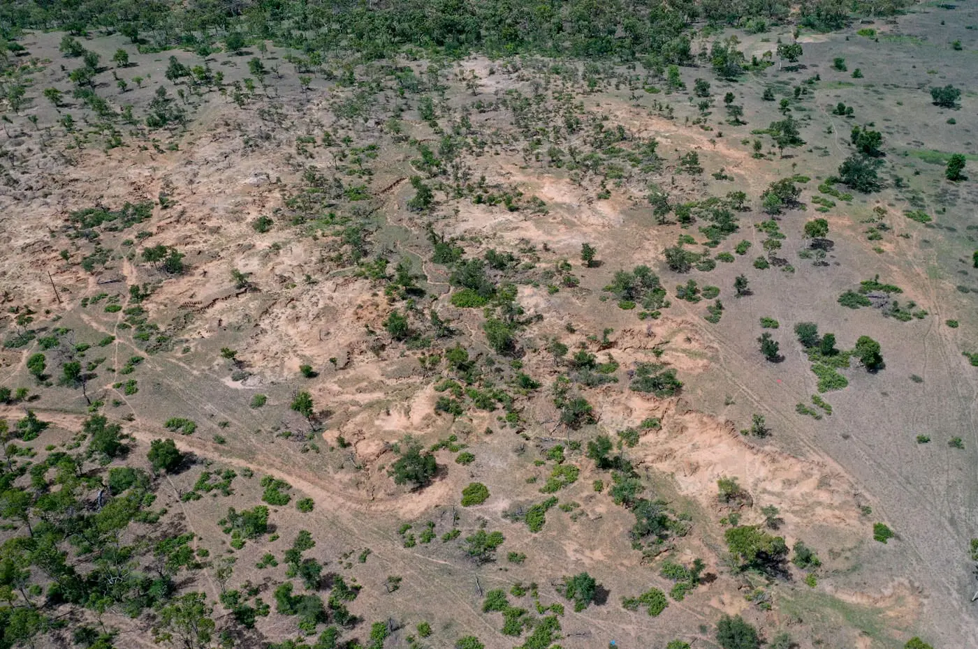
The actively eroding footprint of Gully 2 has a perimeter of about 1km, with an internal area of 1.1ha. The banks of the gully scarp are on average 2.5 – 3m high.
The drainage lines within the gully all converge to a single drainage line that discharges into the Bowen River.
The aerial photographs show the footprint of the gully.
Gully 2
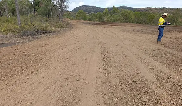
- Reshaping of the northern and central complex gully networks into free draining basins. Reshaping work involved bank battering and reshaping through cut to fill and compaction earthworks operations.
- Reshaping of the southern complex gully network into a stabilised and free draining basin, and reshaped through cut to fill and compaction earthworks operations.
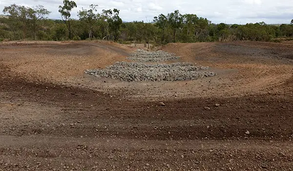
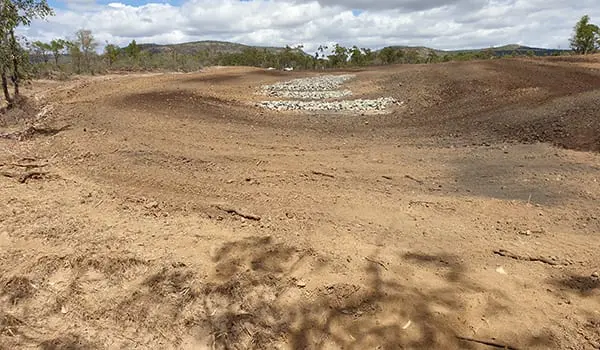
- Construction of three rock cut-off walls at the downstream extent of each of the basin reshaping works.
- Construction of rock check dams on 1m contours in the beds of the reshaped basins.
- Treatment of all the reshaped surfaces consist of:
-
- application of gypsum to all reshaped and disturbed surfaces;
- spreading of topsoil stripped from the footprint of the works; and
- application of soil ameliorants, fertiliser and drill seeding.
Gully 4
Gully 4 has an upstream catchment about four times the size of the gully’s footprint.
The main linear drainage line of the gully appears to have developed due to the concentration of overland flow from the upstream catchment, resulting in linear head cut gullying.
The adjacent alluvial gullies developing off this main gully have no contributing catchment beyond their own footprint and are eroding primarily due to direct rainfall alone. This indicates the soils are highly dispersive, which has been confirmed by soil testing results presented in the assessment report (Griffith University, 2019).
The actively eroding footprint of Gully 4 has a 1.2km perimeter with an internal area of 4.8ha. The banks of the gully scarp are on average 0.6m high.
An aerial photograph which encapsulates the entire footprint of the gully is shown (right).
Aerial photograph of Gully 4 looking downstream from southern extents.
The Gully 4 remediation consists of the following works:
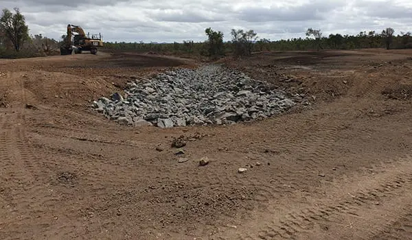
- Construction of a rock chute on the head cut located on the main drainage line with a bund to divert overland flows and control their entry into the gully.
- Construction of a rock chute on the head cut located on the smaller drainage line to the east with a bund to divert overland flows and control their entry into the gully.
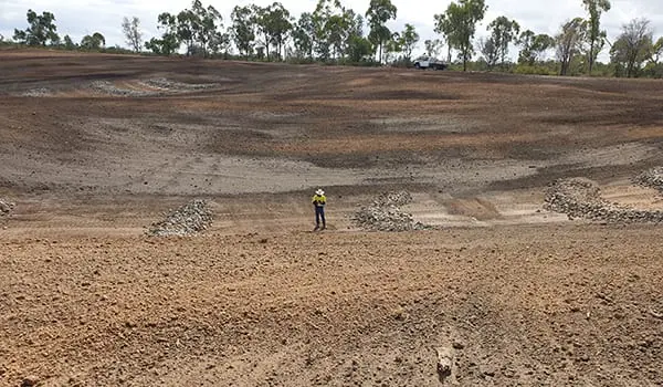
- Reshaping of the actively eroding scarp into a free draining basin to redirect water flow through the reshaped basin and into the main drainage line.
- Reshaping of a steep sloped alluvial gully on the north-eastern extents of Gully 4 into a single stabilised and free draining basin.
- Reshaping of 13 smaller scale alluvial gullies into individual stabilised and free draining areas. Construction of multiple rock check dams, on 0.3m contours in the beds of the reshaped areas as well as throughout the existing main drainage line and a smaller drainage line located to the east.
- Treatment of all the reshaped and regraded surfaces consisting of a minimum of:
- application of gypsum to all reshaped, regraded and disturbed surfaces;
- spreading of topsoil stripped from the footprint of the works; and
- application of soil ameliorants, fertiliser and drill seeding.

